




 This GitHub page and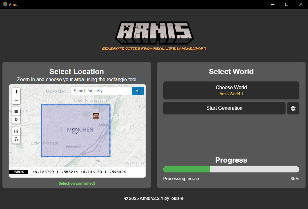


Что это такое?
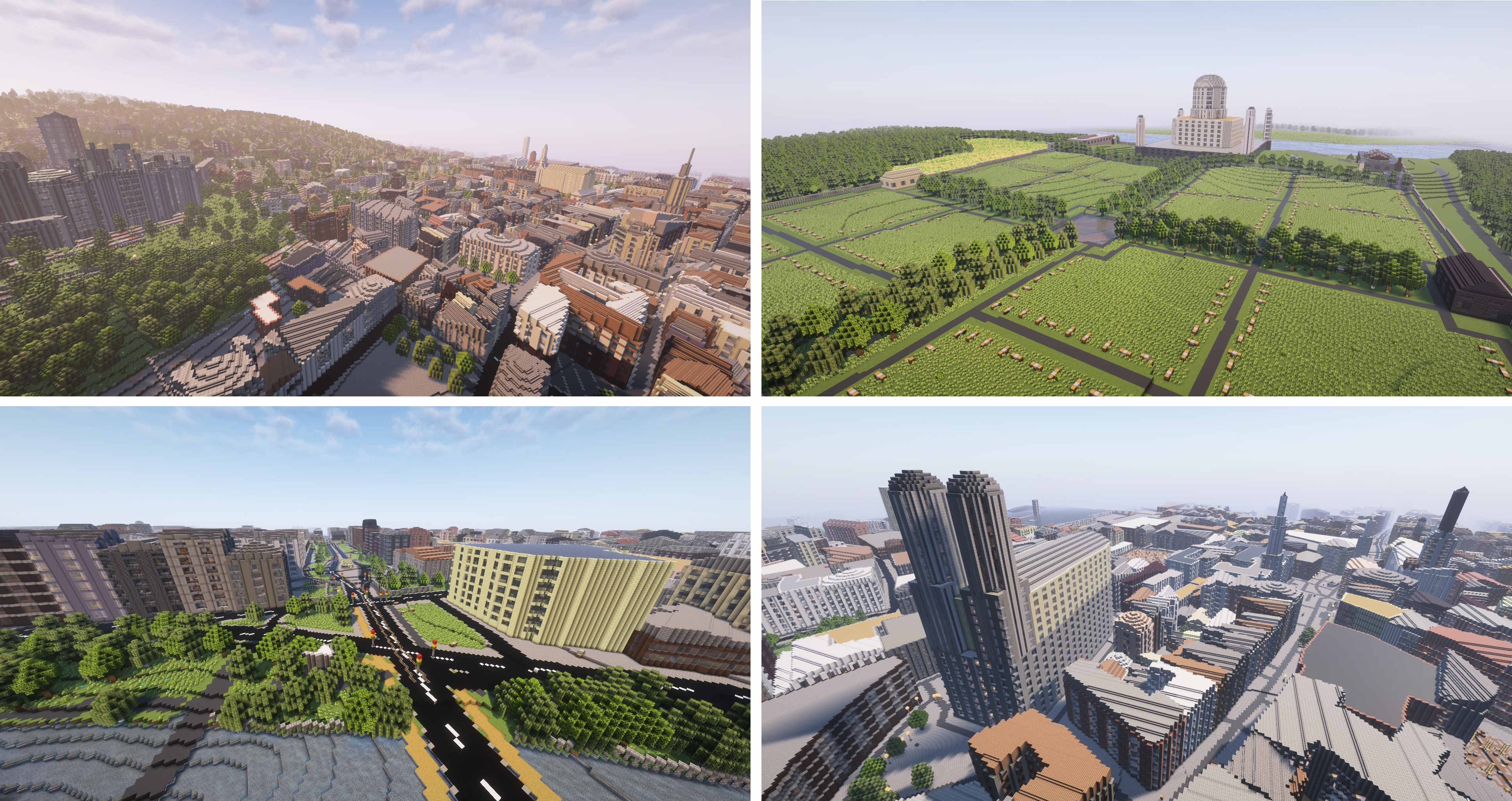
 Arnis создаёт подробные миры Minecraft (Java Edition 1.17+, Bedrock Edition и Luanti/Minetest), которые повторяют реальную географию, загружая данные из OpenStreetMap и источников высот.
Arnis создаёт подробные миры Minecraft (Java Edition 1.17+, Bedrock Edition и Luanti/Minetest), которые повторяют реальную географию, загружая данные из OpenStreetMap и источников высот.Это приложение для рабочего стола или консольная утилита?И то, и другое: графическое приложение для рабочего стола (на базе Tauri) и консольная утилита с собственными флагами. Можно выбрать область на карте или запустить генерацию без интерфейса через командную строку.
И то, и другое: графическое приложение для рабочего стола (на базе Tauri) и консольная утилита с собственными флагами. Можно выбрать область на карте или запустить генерацию без интерфейса через командную строку.Как сгенерировать мир?Скачайте последний релиз или соберите программу сами, затем выберите область инструментом «прямоугольник» на карте, укажите папку с миром Minecraft и нажмите «Начать генерацию».
Скачайте последний релиз или соберите программу сами, затем выберите область инструментом «прямоугольник» на карте, укажите папку с миром Minecraft и нажмите «Начать генерацию».Нужно ли что-то устанавливать помимо самого приложения?Никакие внешние учётные записи не нужны: приложение само загружает данные OpenStreetMap и высот. Пользователи Nix могут также запустить его напрямую командой 'nix run'.
Никакие внешние учётные записи не нужны: приложение само загружает данные OpenStreetMap и высот. Пользователи Nix могут также запустить его напрямую командой 'nix run'.Что меняют разные режимы генерации?Флаг --mode определяет, что именно будет построено: 'geo-terrain' размещает здания и дороги на реальном рельефе местности (по умолчанию), 'geo-only' ставит объекты OSM на ровную поверхность, а 'terrain-only' создаёт только реальный рельеф без каких-либо объектов OSM.
Флаг --mode определяет, что именно будет построено: 'geo-terrain' размещает здания и дороги на реальном рельефе местности (по умолчанию), 'geo-only' ставит объекты OSM на ровную поверхность, а 'terrain-only' создаёт только реальный рельеф без каких-либо объектов OSM.На каких операционных системах работает программа?Arnis в первую очередь рассчитан на Windows, macOS и Linux.
Arnis в первую очередь рассчитан на Windows, macOS и Linux.Безопасно ли скачивать Arnis только с GitHub?Да: в проекте прямо предупреждают, что официальны только эта страница GitHub и arnismc.com, а любой другой источник загрузки может быть вредоносным.
Да: в проекте прямо предупреждают, что официальны только эта страница GitHub и arnismc.com, а любой другой источник загрузки может быть вредоносным.Можно ли пользоваться Arnis без установки?Да, есть вспомогательный инструмент MapSmith: он создаёт миры прямо в браузере без установки, а также поддерживает генерацию с мобильных устройств и карты большего размера.
Да, есть вспомогательный инструмент MapSmith: он создаёт миры прямо в браузере без установки, а также поддерживает генерацию с мобильных устройств и карты большего размера.Можно ли настроить что-то, кроме самой области?Да, можно изменить такие параметры, как масштаб мира, точка появления игрока и то, генерировать ли внутренние помещения зданий.
Да, можно изменить такие параметры, как масштаб мира, точка появления игрока и то, генерировать ли внутренние помещения зданий.Получал ли Arnis признание за пределами проекта?Да: о нём писали Hackaday, Tom's Hardware и XDA Developers, а также его использовали в научных работах, включая кейс AWS о наборах данных высот и обучающую игру Floodcraft о наводнениях для школьников (K-12).
Да: о нём писали Hackaday, Tom's Hardware и XDA Developers, а также его использовали в научных работах, включая кейс AWS о наборах данных высот и обучающую игру Floodcraft о наводнениях для школьников (K-12).Что делает флаг --overture?Это дополнительный вариант загрузки данных, но он не действует в режиме terrain-only, так как этот режим полностью пропускает и запрос к OpenStreetMap, и загрузку Overture.
Это дополнительный вариант загрузки данных, но он не действует в режиме terrain-only, так как этот режим полностью пропускает и запрос к OpenStreetMap, и загрузку Overture.What are similar projects?escrcpy, spacedrive, SwitchHosts, dbx, BongoCat, ooosplat, omnyssh, photosuite
escrcpy, spacedrive, SwitchHosts, dbx, BongoCat, ooosplat, omnyssh, photosuiteWhich topics is it in?mapping, openstreetmap, minecraft, procedural-generation, geospatial, tauri, rust, gui, desktop-app, apache-2.0, cross-platform, windows
mapping, openstreetmap, minecraft, procedural-generation, geospatial, tauri, rust, gui, desktop-app, apache-2.0, cross-platform, windows