
RustGIS
A fast, free and open-source GIS in pure Rust for mapping, analyzing and sharing geospatial data.
Native on Windows, macOS and Linux, and in your web browser. Your data stays on your machine
unless you send it to an AI model you choose, and every action is a command you can script.









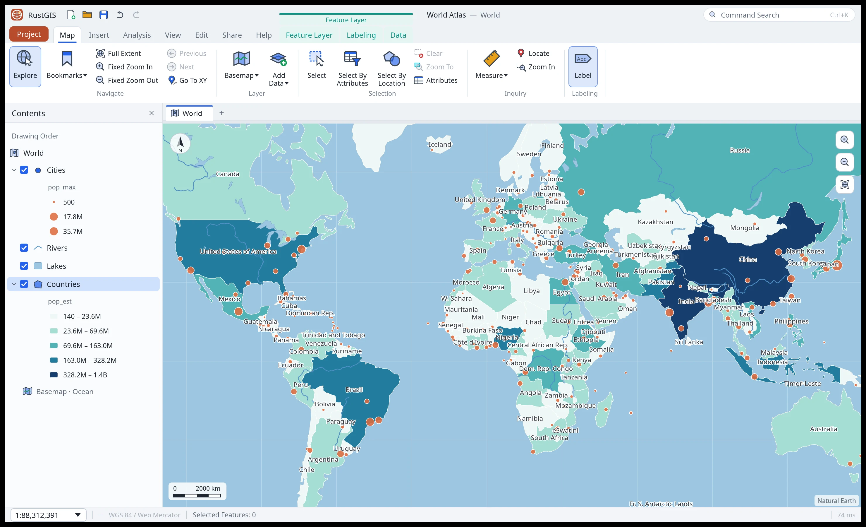
Why RustGIS
- Fast and small. One native program, drawn on the GPU, with no runtime to install and no
server to run.
- Runs everywhere. The same app on Windows, macOS and Linux, and compiled to WebAssembly at
web.rustgis.app with nothing to install.
- Local and private. Your files are read and written on your machine, and nothing is uploaded
on its own. The network is used only when you ask for it: web basemaps, plugins, the GeoLibre
tools and the AI model you pick, which receives your questions and the data it reads to answer
them.
- Everything is a command. Every button in the ribbon is a command with an id. Script it from
rustgis-cli, chain it in notebooks and models, or ask the AI Assistant to run it for you.
- Familiar. A ribbon laid out in the order of the work (Home, Data, Style, Edit, Analyze,
View, Publish), Layers and Browser panes, an attribute table, and undo for every change.
- Extensible. Over 1,000 GeoLibre and Whitebox tools for terrain, hydrology, LiDAR and remote sensing, and
sandboxed WebAssembly plugins that add commands, tools and ribbon tabs.
A tour
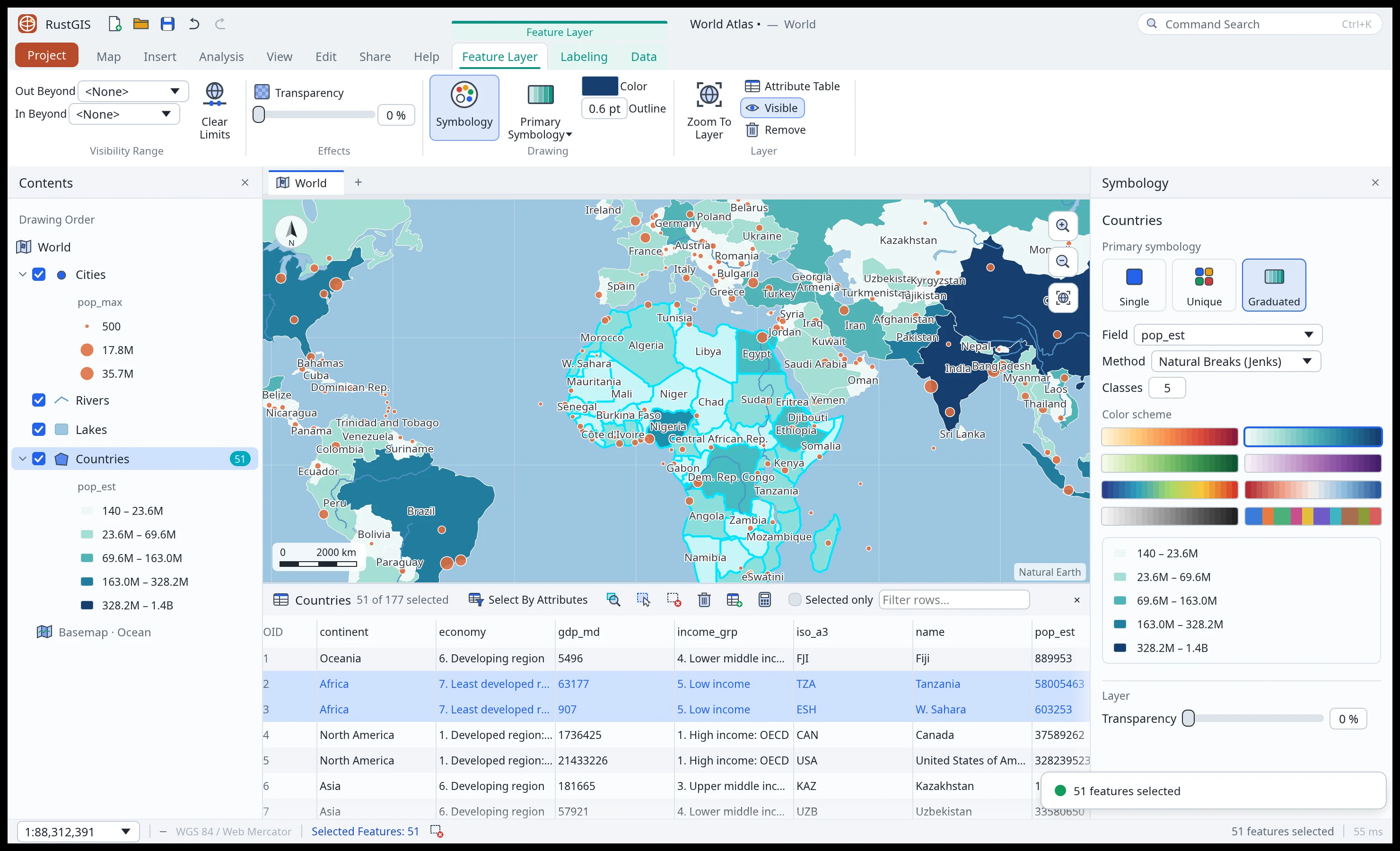 Symbology and tables. Selecting a layer opens its contextual tabs: symbology, effects, labeling and data. Selection is synced between the map and the attribute table. |
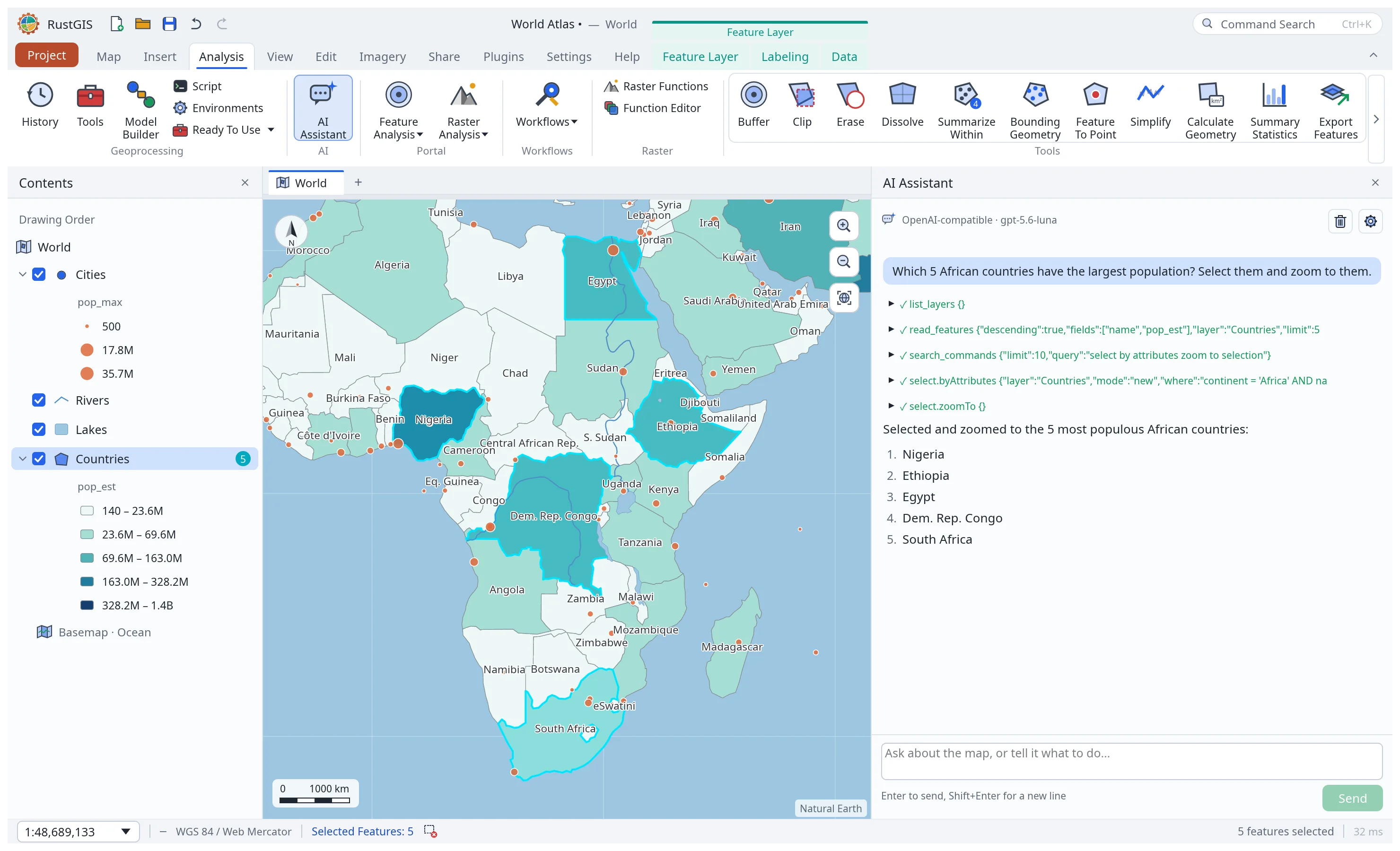 AI Assistant. Ask about your data or tell the map what to do. The assistant runs RustGIS commands for you, and each change can be undone. |
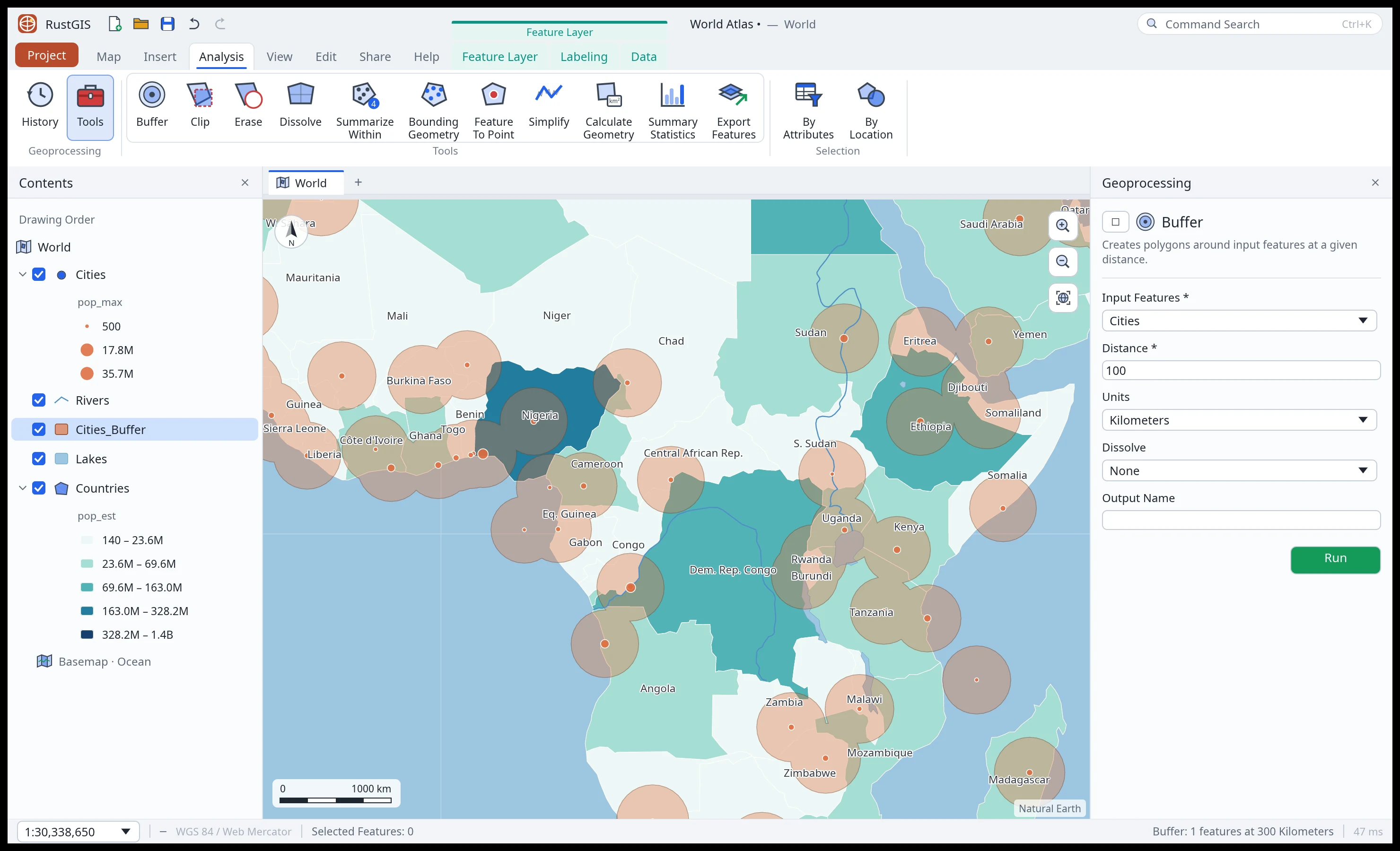 Analysis. A tool gallery, the Tools pane and a run history, guided workflows, ModelBuilder, and 1,000+ GeoLibre and Whitebox tools. |
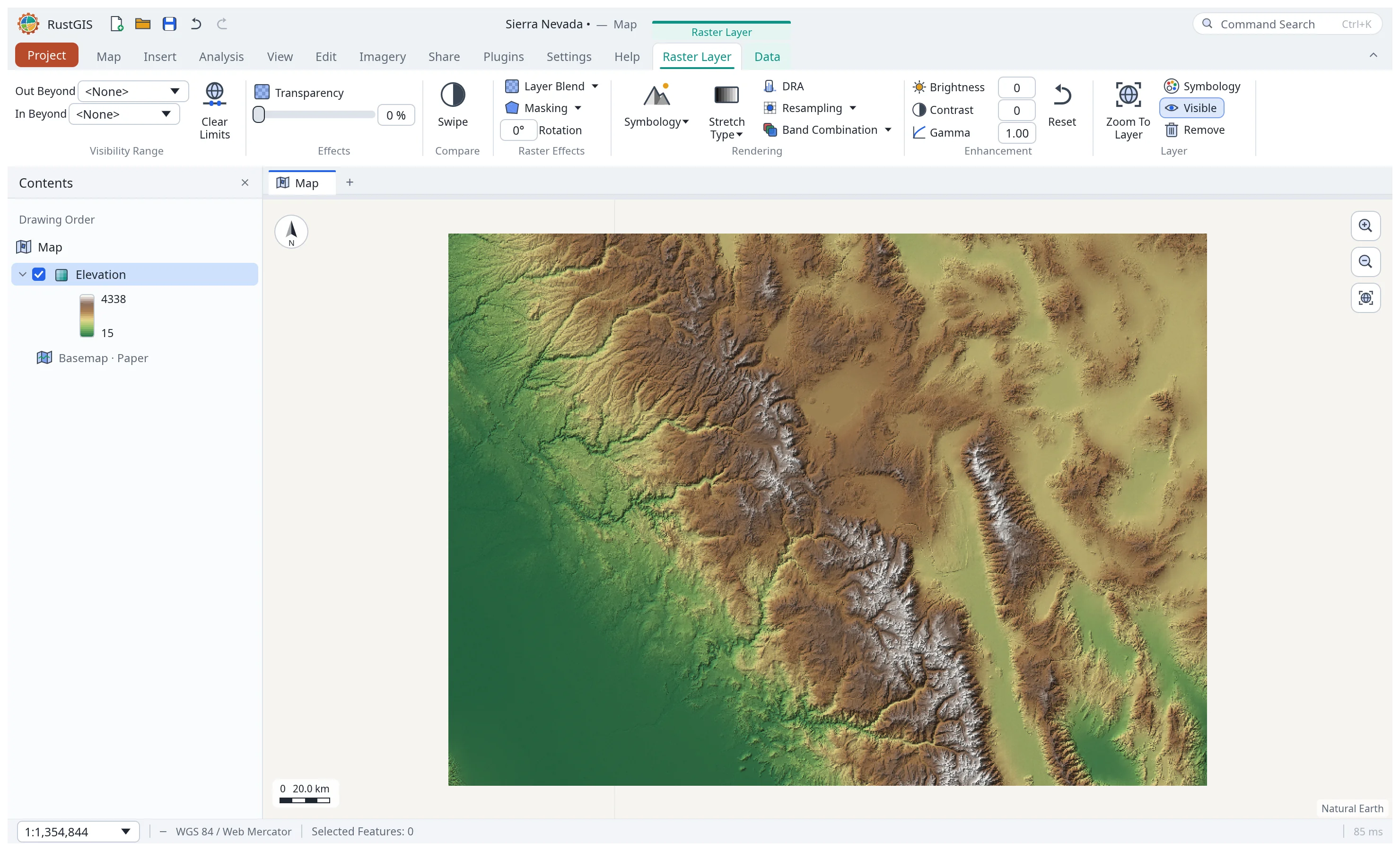 Rasters. GeoTIFF and COG of any pixel type, reprojected on the fly, with stretch, RGB, classified and shaded-relief symbology. |
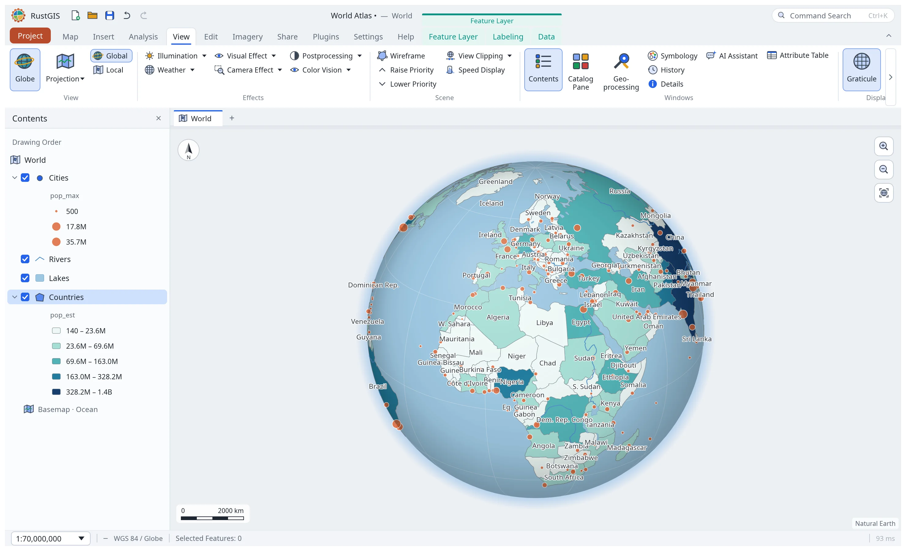 Globe and projections. A 3D globe, Equal Earth, Robinson, polar and regional presets, or any EPSG code. |
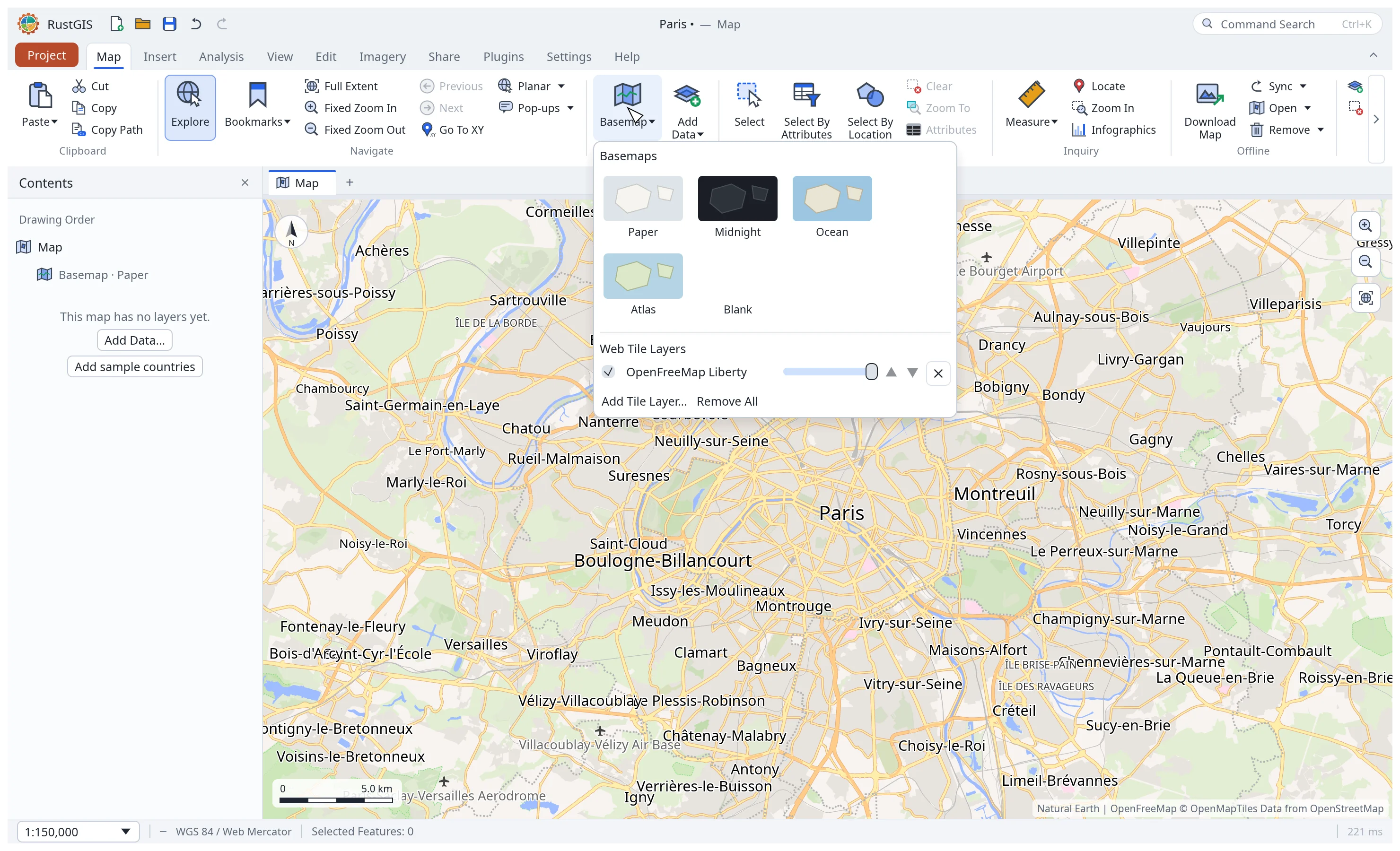 Web basemaps. XYZ, TMS and WMS tiles, Mapbox Vector Tiles and MapLibre styles, on the flat map and the globe. |
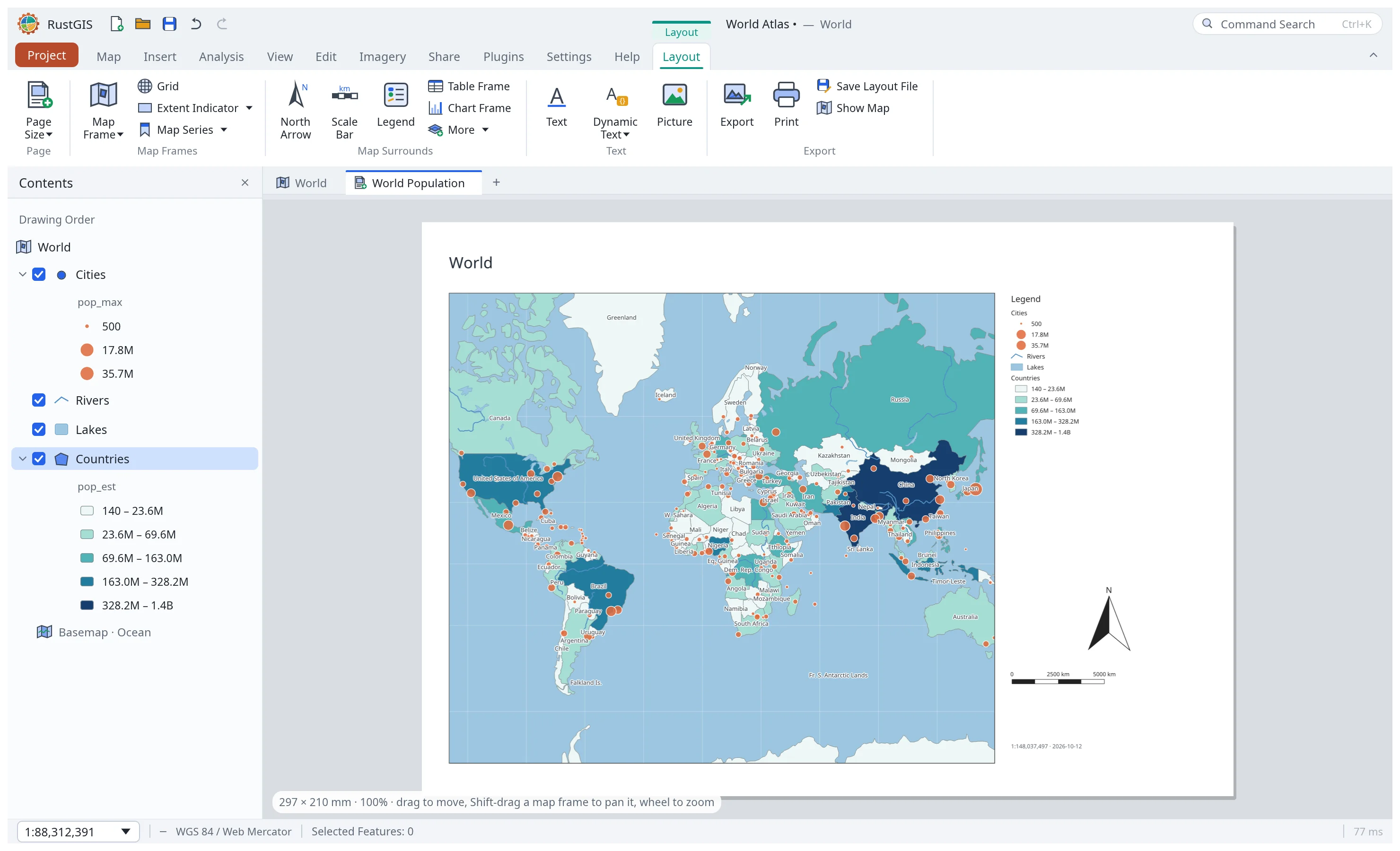 Layouts. Map frames, legends, scale bars, grids, map series and PDF export, plus reports and presentations. |
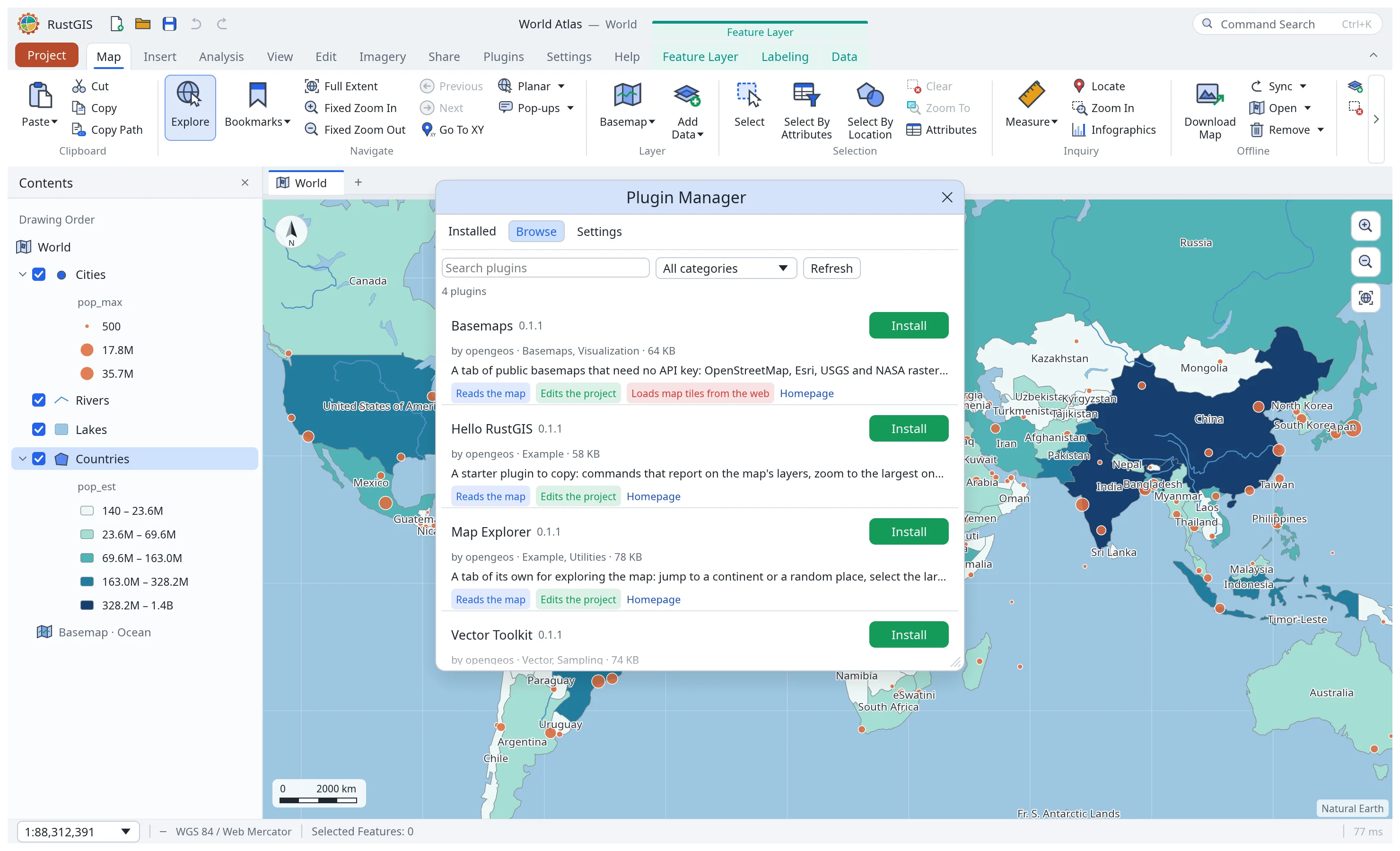 Plugins. Browse and install sandboxed plugins from plugins.rustgis.app, each showing the permissions it asks for. |
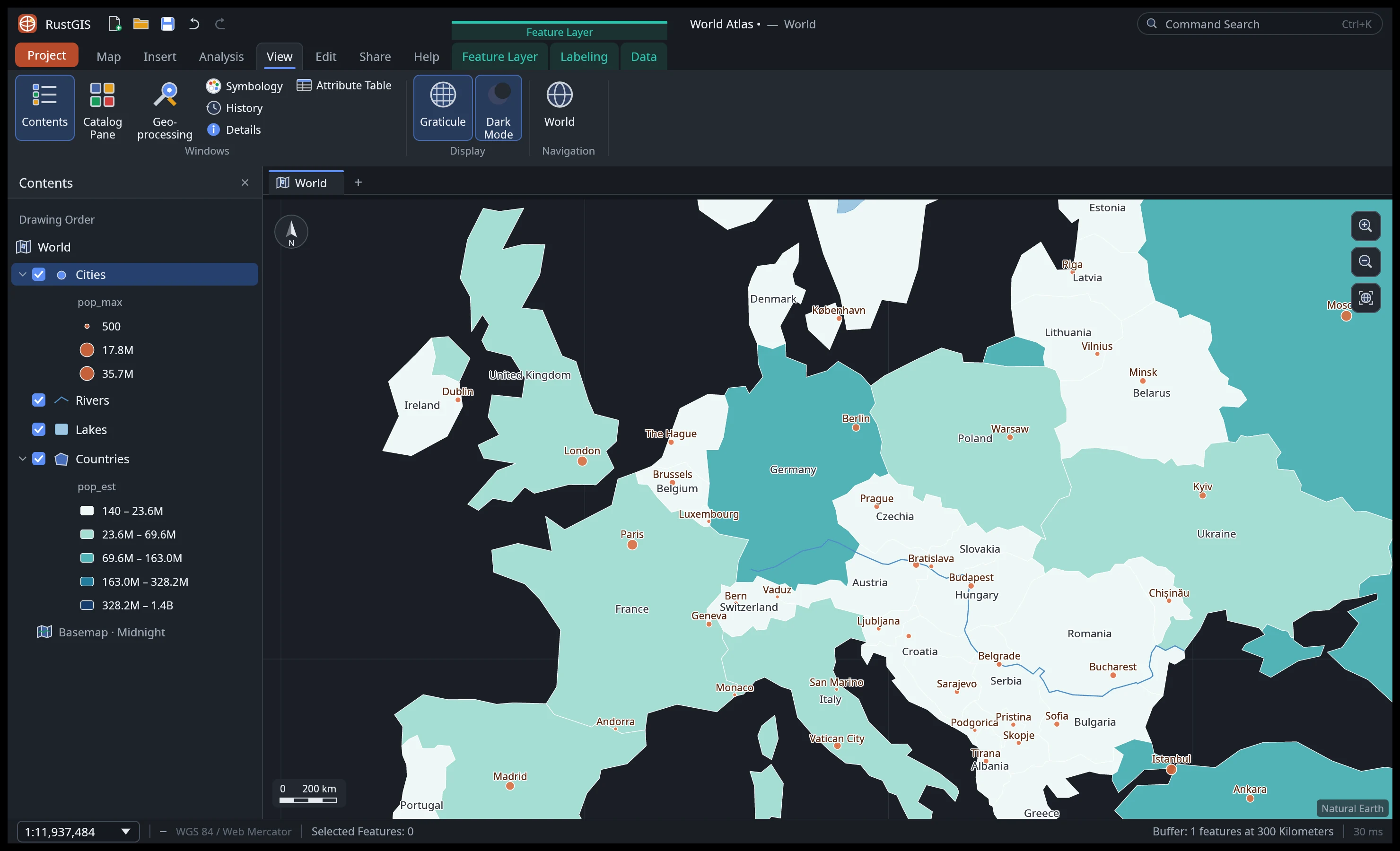 Dark mode and the View tab: effects, scene settings, panes and linked views. |
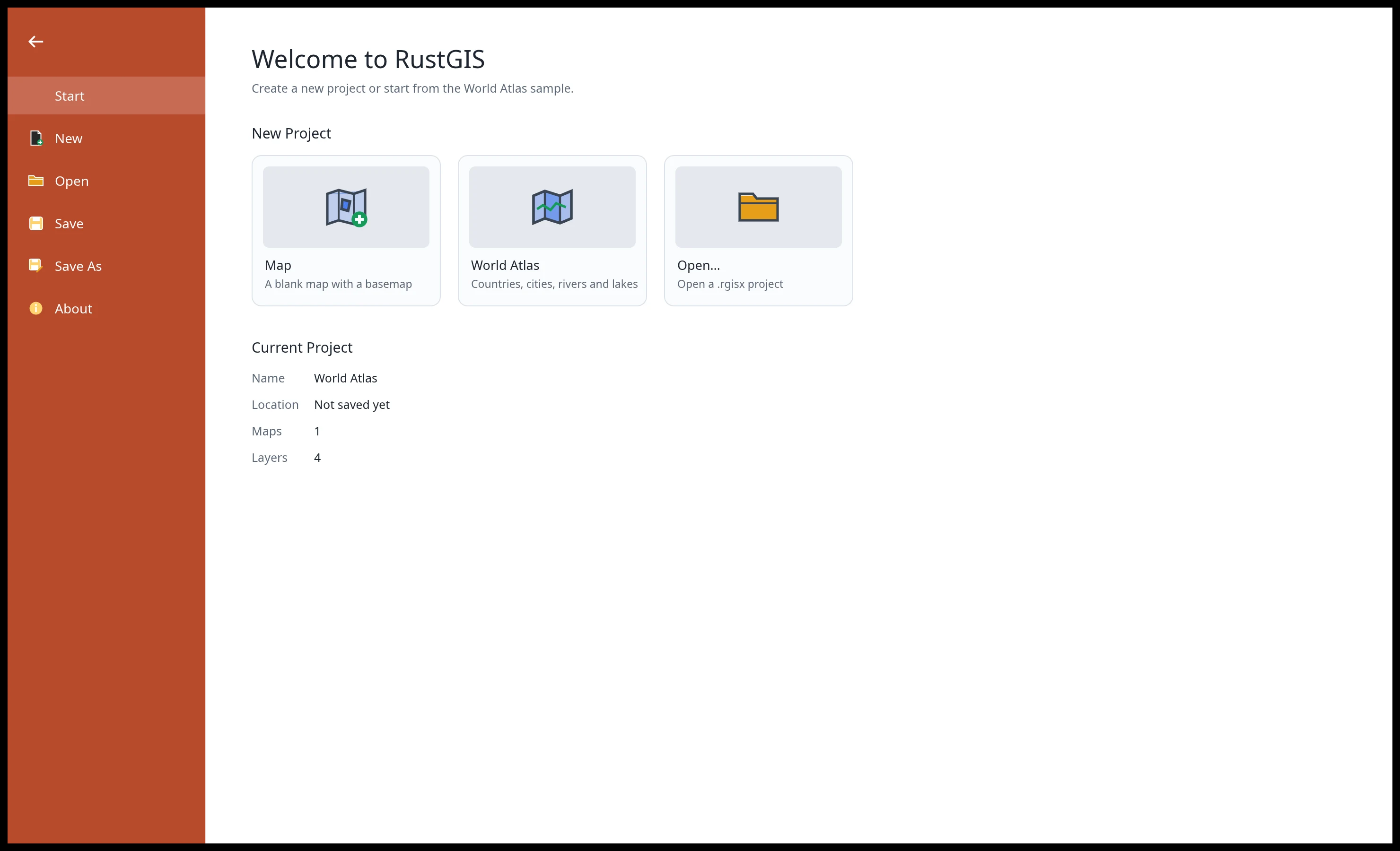 Projects. Start blank, from the World Atlas sample, or open a .rgis project. |
Every screenshot is RustGIS itself, rendered offscreen by cargo run -p rustgis-ui-egui --example ui_shot.
Features
| Area |
Highlights |
| Data |
GeoJSON, CSV/TSV with x/y columns in any coordinate system or WKT geometry, Excel and OpenDocument spreadsheets, GeoRSS, LandXML, encoded polylines, Shapefile (zipped too, in the browser as well), GeoPackage, GeoParquet, FlatGeobuf, KML/KMZ (with styles), GPX, GML, MapInfo MIF/MID, OpenStreetMap PBF, TopoJSON, AutoCAD DXF, LiDAR point clouds (LAS, LAZ, COPC) and geotagged photos in (large files read in place), files by their web address, every vector format GDAL reads when it is installed, and SQL queries and DuckDB databases through DuckDB Spatial when DuckDB is; PMTiles archives (web or file) and MBTiles files; GeoJSON, CSV, GeoPackage, GeoParquet, Shapefile, FlatGeobuf, KML/KMZ, GPX and WKT out; standalone tables; layer and map files, styles, templates and packages |
| Rasters |
GeoTIFF and cloud-optimised GeoTIFF (any pixel type, tiled or striped, compressed), ASCII grids, Zarr 2 and 3 stores (a variable at a time step, by folder or web address); reprojection from any EPSG code; Stretch, RGB, Classify, Unique Values, Colormap and Shaded Relief; DRA, band combinations, brightness/contrast/gamma; raster functions, indices, change detection, classification, georeferencing |
| Maps |
Multiple maps per project; a 3D globe; Web Mercator or any projection (Equal Earth, Robinson, Winkel Tripel, polar and regional presets, or an EPSG code); bookmarks, extent history, Go To XY; five offline basemaps |
| Web services |
WMS, WMTS, WFS, OGC API Features and ArcGIS REST (FeatureServer, MapServer, ImageServer, VectorTileServer) from their capabilities |
| Web tiles |
XYZ/TMS/WMS raster tiles, Mapbox Vector Tiles and MapLibre styles (sprites, patterns, expressions), cached and fetched in the background |
| Cartography |
Single symbol, unique values, graduated colours, proportional symbols; collision-free labels with placement, scale ranges and annotation; masking, display filters, aggregation bins, 2.5D extrusion; graphics and dynamic text |
| Editing |
Create, move, rotate, scale, merge, split and explode features; snapping, templates, elevation, traverse, topology rules; domains, subtypes, attribute rules, relationships, archiving; undo for everything |
| Analysis |
Selection by attributes (SQL) and location; Buffer, Clip, Erase, Dissolve, Summarize Within, Summary Statistics and more; viewshed, line of sight, IDW, shortest path, suitability modelling; ModelBuilder and scripts; 1,000+ GeoLibre and Whitebox raster, vector, LiDAR, hydrology and terrain tools |
| Imagery |
Ortho and reality mapping, pixel classification (k-means, minimum distance, a trainable neural network), mensuration, hosted imagery tiles |
| Layouts and reports |
Page layouts with map frames, legends, scale bars, grids and map series; reports with groups, statistics, charts and subreports; presentations (HTML slideshow, PDF); notebooks (Jupyter in and out) |
| Sharing |
PNG export at any DPI; PDF; web map pages, OGC API Features collections, MapLibre styles, glTF scenes, locators; project, map and mobile map packages; offline areas with sync |
| AI Assistant |
Ask about your data or tell the map what to do in plain language, with Anthropic, OpenAI, Gemini, OpenRouter, Ollama or any OpenAI-compatible model; also rustgis-cli ask, and an MCP server (rustgis-cli mcp) for Claude Code, Cursor, VS Code and other agents |
| Plugins |
Sandboxed WebAssembly plugins add commands, tools and ribbon tabs; install them from plugins.rustgis.app on the desktop, command line and web |
| Interface |
Command search (Ctrl+K), keyboard shortcuts, dark mode, a customizable ribbon and Quick Access Toolbar, linked side-by-side maps, 16 languages |
The user guide covers each area in detail,
Comparison sets RustGIS beside GeoLibre, QGIS and ArcGIS, and
ROADMAP.md lists what's next.
Get RustGIS
- Web app: open web.rustgis.app. The same ribbon and tools,
with the browser's file picker for data and projects, and downloads for Save and Export.
- Desktop: download the app for Windows, macOS or Linux from
downloads.rustgis.app or the
latest release (see
Installation for the files and first-run notes).
- Package managers:
winget install OpenGeos.RustGIS,
brew install --cask opengeos/rustgis/rustgis, yay -S rustgis-bin (AUR), or
sudo dnf copr enable giswqs/rustgis && sudo dnf install rustgis (Fedora).
- From source:
cargo run --release -p rustgis (Rust 1.90 or later).
Quick start
cargo run --release -p rustgis                       # the desktop app with the World Atlas sample
cargo run --release -p rustgis -- data.geojson       # open data (or a .rgis project)
Command line: every ribbon action is a command with an id.
rustgis-cli commands                                 # all command ids and parameters
rustgis-cli render countries.geojson map.png --basemap ocean
rustgis-cli run --sample \
  --cmd 'gp.run={"tool":"countPoints","params":{"polygons":"Countries","points":"Cities"}}' \
  --cmd 'layer.symbology={"layer":"Countries_Summarize","type":"graduated","field":"point_count"}' \
  --cmd 'share.exportMap={"path":"out.png","dpi":192}' --save atlas.rgis
rustgis-cli ask --sample "Which 5 countries have the largest GDP?"
claude mcp add rustgis -- rustgis-cli mcp --sample   # RustGIS as an MCP server for AI agents
See Command Line for more.
Python: the same engine and commands in-process (pip install rustgis), and the app itself in a
Jupyter notebook.
import rustgis
s = rustgis.Session(sample=True)
s.run("gp.run", tool="buffer", params={"input": "Cities", "distance": 100})
s.to_png("map.png")
gdf = s.layer("Cities_Buffer").to_geopandas()
See Python and the getting-started notebook
(open in Colab).
Architecture
Layered crates, each depending only on the ones below it:
| Layer |
Crate |
Job |
| L0 |
rustgis-geom |
coordinates, extents, Web Mercator, geodesic distance/area, scale |
| L1 |
rustgis-data |
features and typed attributes; GeoJSON, CSV, Shapefile; GeoPackage, GeoParquet and FlatGeobuf providers; SQL where clauses; rasters and their coordinate systems |
| L2 |
rustgis-map, rustgis-analysis |
layers, symbology, labeling, camera, basemaps; geoprocessing (on geo) |
| L2 |
rustgis-tiles |
web map tiles: XYZ/TMS/WMS, Mapbox Vector Tiles, MapLibre styles, the tile cache |
| L3 |
rustgis-render |
tiny-skia renderer, label placement, PNG export, fonts |
| L3 |
rustgis-plugins |
sandboxed WebAssembly plugins and the plugin registry |
| L3 |
rustgis-geolibre |
the GeoLibre tool suite as geoprocessing tools |
| L4 |
rustgis-engine |
session, undo, command registry, sample project |
| L5 |
rustgis-assistant |
the AI Assistant: a chat agent that acts through commands |
| L6 |
rustgis-ui-egui |
the ribbon front end (swappable) |
| apps |
rustgis, rustgis-cli, rustgis-web |
desktop, command line, browser (WebAssembly) |
cargo xtask ci runs formatting, clippy, the tests and the layering check. Contributor and
agent notes: AGENTS.md.
RustGIS is free and open source, and stays that way. If it is useful to you or your team, sponsorship is the most direct way to keep development, hosting and cross-platform distribution going.
See the Become a Sponsor page for what sponsorship supports and for other, free ways to help.
License and credits
Licensed under the Apache License 2.0. Sample data from
Natural Earth (public domain).

 RustGIS 是一款免费开源的 GIS 应用,完全用 Rust 编写,可用于绘制地图、分析地理空间数据并共享成果。